India’s infrastructure, mining, renewable energy and smart city projects demand reliable and engineering-grade geospatial intelligence. Drone surveying services in India are redefining how large-scale mapping, terrain modelling and corridor assessments are executed. At Dhaksha Unmanned Systems, advanced UAV platforms combined with trained and certified pilots deliver high-precision outputs suitable for industrial, government and enterprise applications.
With a strong manufacturing base and operational expertise, Dhaksha supports organisations seeking scalable and compliant UAV mapping services in India for modern infrastructure development.
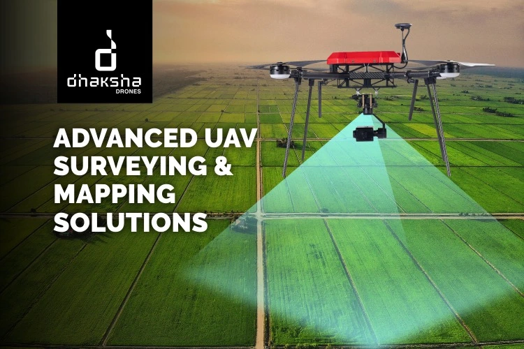
Why Drone Surveying Is Transforming Indian Projects
Traditional land surveys often require extensive manpower, longer project timelines and physical access to challenging terrain. In contrast, UAV-based mapping enables rapid aerial data acquisition with minimal site disruption. Using RTK drone survey and PPK drone mapping systems, centimetre-level accuracy is achieved, ensuring reliable data for feasibility studies, engineering design and regulatory documentation.
The ability to capture high-resolution imagery and process it through professional photogrammetry services India strengthens decision-making and reduces project delays.
Topographic Drone Survey for Precision Terrain Analysis
A topographic drone survey is widely used in highway construction, industrial parks, urban planning and renewable energy site development. Advanced sensors, including LiDAR drone survey systems, generate contour maps, 3D terrain models and Digital Elevation Model (DEM) survey outputs.
Compared to conventional surveying methods, drone-based mapping reduces turnaround time while improving repeatability and accuracy. The resulting orthomosaic mapping datasets provide engineers with actionable terrain insights, including slope analysis and surface variation mapping.
Drone Land Survey Services for Boundary & Asset Mapping
Drone land survey services support land parcel demarcation, acquisition projects and infrastructure planning. Through integrated drone GIS mapping, aerial data is converted into geo-referenced outputs compatible with CAD and GIS platforms. This ensures improved transparency, reduced manual errors and enhanced documentation for compliance and planning purposes.
For organisations seeking reliable aerial mapping services India, UAV platforms provide scalable solutions for both small and large-area land assessments.
Mining Drone Survey & Stockpile Analysis
In mining operations, a mining drone survey enables accurate stockpile measurements and excavation monitoring. Using stockpile volume calculation drone technology, operators can measure material quantities with high consistency and minimal operational interruption. Frequent UAV assessments enhance production monitoring, cost control and compliance reporting.
Infrastructure Drone Survey & Corridor Mapping
Large-scale projects such as highways, transmission lines and pipelines benefit from infrastructure drone survey solutions. Corridor mapping using drones ensures continuous and high-density data capture across extended distances. The integration of 3D drone mapping services supports alignment planning, safety analysis and construction monitoring.
Dhaksha’s UAV platforms are designed to deliver reliable performance across varied terrain conditions, ensuring operational continuity and data consistency.
Advanced Technology Behind Professional UAV Mapping
High-performance drone surveying services in India rely on RTK-enabled systems, advanced imaging sensors and precision processing workflows. Whether it is RGB imaging for detailed surface capture or LiDAR integration for enhanced elevation modelling, UAV systems provide engineering-grade deliverables.
Choosing the best drone for survey mapping depends on project size, terrain complexity and required accuracy benchmarks. Fixed-wing UAVs offer extended coverage for large projects, while multirotor systems are suitable for detailed site inspections.
Integrated Training & Skilled Operations
High-quality drone surveying requires certified pilots and structured training. As a DGCA-approved RPTO operator, Dhaksha supports skill development and capacity building across India. Organisations and individuals searching for the best drone training institute in India benefit from structured training modules covering UAV operations, mapping workflows and safety compliance.
By combining manufacturing expertise with pilot training, Dhaksha strengthens the ecosystem required for reliable UAV mapping services India.
Industries Driving Demand for UAV Mapping
The adoption of drone surveying services in India is expanding across construction, mining, oil and gas, renewable energy, agriculture and smart city projects. The push for digital land records and precision infrastructure planning has further accelerated demand for advanced drone GIS mapping solutions.
The Future of Drone Surveying in India
With continued infrastructure investment and technological advancements, UAV-based mapping is becoming an industry standard. AI-driven analytics, autonomous flight planning and improved LiDAR capabilities will further enhance efficiency and accuracy.
Drone surveying services in India are no longer experimental technologies but strategic tools enabling faster decision-making, cost optimisation and scalable development.
Frequently Asked Questions (FAQs)
1. What are drone surveying services in India used for?
Drone surveying services in India are used for topographic mapping, land boundary surveys, mining assessments, infrastructure corridor mapping and 3D terrain modelling. UAVs capture high-resolution aerial data that is processed into orthomosaic maps and elevation models for engineering and planning applications.
2. How accurate is a drone land survey?
A professional RTK drone survey or PPK drone mapping operation can achieve horizontal accuracy of approximately 2–5 cm when supported by ground control points. This level of precision makes drone land survey services suitable for large-scale infrastructure and industrial projects.
3. What industries benefit from UAV mapping services India?
Construction, mining, renewable energy, oil and gas, agriculture and urban development sectors benefit significantly from UAV mapping services India. These services improve planning accuracy and reduce operational risks.
4. What deliverables are included in a topographic drone survey?
A topographic drone survey typically provides orthomosaic mapping, contour datasets, Digital Elevation Model survey outputs, 3D terrain models and CAD-compatible files.
5. How do I select the best drone for survey mapping?
Selecting the best drone for survey mapping depends on project area, terrain complexity and accuracy requirements. Advanced RTK capability, sensor quality and regulatory compliance are key factors in professional aerial mapping services India.